Wednesday, August 14, 2013

Slate Islands

When we left Rossport Wednesday morning, the skies were overcast.  By the time we arrived at the Slate Islands, a group of eight islands 23 miles south of Rossport, the sun was shining and it was a gorgeous day.  According to Bonnie Dahl, “When you look at the circular shape of the Slate Islands on a chart, it is easy to see how they could have resulted from the impact of a huge (19 mile wide) asteroid. “ In the past these islands were the sight of extensive lumbering operations—the results of which are still seen in the lake bottom as deadheads and slash.  We set the anchor in Pike’s Bay with a trip line (an extra line attached to the head of the anchor) in case we got hung up on one of the above.  I was feeling a bit under the weather (turned out to be a 24-hour bug), so I stayed aboard later and Tom went fishing.  Upon returning, he told me he guessed we’d have to have peanut butter and jelly, and then smirked and pulled up this beautiful trout.  Later that evening, he watched as a bald eagle swooped down to help himself to the filleted carcass.
Dinner!

Thursday dawned sunny!!!!  We took advantage by dinking around the inner waters of the islands and stopping for a hike.  Soon after we returned to Raydiance, a female caribou strolled along the beach.  She was molting and so skinny her ribs were showing.  Caribou supposedly are abundant in the islands, but this was the first one we saw.
Unhealthy looking female caribou

View of the Slates

Approaching the Slates

Voyager canoe

An outfitter from Terrace Bay, Ontario brings people and kayaks or canoes to the Slates and comes back at an arranged time to pick them up.  We met two couples who had done this when we went hiking at a meadow area. The large Voyager canoe was manned by three families from Thunder Bay.  By staying in sync with their paddling,  they could really move through the water.  I think there were eight people in the canoe when this picture was taken.


 Early Friday afternoon,  Daydreams and Waterford arrived.  They joined us for cocktails that evening with the understanding that we were heading by dink to the meadow around eight.  Earlier in the day while on a solo dinghy ride, I had run across one of the men we had met at the meadow the day before.  He said they had been visited by a male, female and calf the previous night.  We actually arrived a little later, but we did see a much healthier female.  We waited around for the rest of the fam, but apparently they didn't get the memo.
The Krogan crews on caribou patrol.
Jan is crouched down near the bow,
but she is there!

A much healthier looking female
caribou grazing in the meadow.

Monday, August 5, 2013

Thunder Bay to Rossport

We left Isle Royale on Wednesday, July 31st, and turned north to Thunder Bay.  Thunder Bay sits in a bowl surrounded by towering granite cliffs.  On the southern tip of the Sibley Peninsula at the entrance to the bay,   a 5 mile long cliff known as “the sleeping giant” stands guard.  An equally impressive cliff borders the northern peninsula.  The dockmaster at Thunder Bay Marina, Kevin, was extremely accommodating.  He picked us up at the grocery store and took Tom to a Walmart that was a bit too far to walk.  Three Kadey Krogans ( very sturdy trawlers) were tied up at the dock near us.  Two were traveling together, and all three were circumnavigating  Superior counter-clockwise, as are we.  The two 39 foot Krogans were from the west end of Lake Erie and the 48 footer started near Charlevoix.   The windy, rainy weather continues with a clear day about one in three.
Wading fountain which doubles as
ice skating rink.  It's almost cold enough
to be skating now!

Arriving in Thunder Bay with Ontario flag and
Quarantine flag flying

Surrounded by Krogans


Friday, August 2nd, we left Thunder Bay with several choices in mind for anchorages.  We passed close to the sleeping giant as we left, and with the clouds above him, he appeared to be smoking a peace pipe.  The water was fairly calm and the day was again overcast, so we decided to keep going, 58 miles, to Otter Cove.  As we entered the cove, we passed a one hundred foot yacht, Constellation, at anchor in the outer basin.  They didn’t invite us to tie up along -sideJ, so we kept going through a narrow passage (never registering less than ten feet depth) and anchored in the far eastern end on the inner basin.  Around dusk the wind came up in major gusts and pulled us free.  We reset, put out more line, and then stayed in place though we did some major swinging.  Saturday was again blustery and cool.  We took a dink ride around the inner basin and Tom threw out some casts, but we did not have trout for dinner!  On such days we read, clean and play games—mostly cribbage.  I cannot believe the incredible luck my husband has for drawing cards; either that or he is cheating and I just haven’t caught him.  Needless to say, my running score is rather pitiful!
Ridge on northern side of Thunder Bay

Can you believe they didn't
invite us to join them??

Sea Lion rock formation
passed just outside Thunder Bay

Sleeping Giant with peace pipe


Getting our ducks in a row
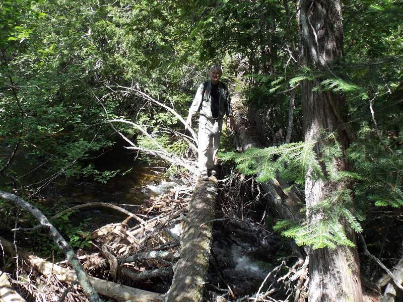
Sunday the sun was shining and not a cloud was in the sky. Mid morning, the two smaller Krogans pulled into the basin.  We visited with them by radio and then dinked up a small stream to a waterfall.  With all the rain this year, it was really roaring. We hiked to the top of the falls and then decided to follow the mile trail to the lake that fed the waterfall.  The trail was marked with orange plastic ribbons and was a bit muddy, but it felt great to stretch our legs.  We met the “Krogan couples” (Doug and Jan Martin aboard Daydreams and Garry and Jacque Nelson aboard Waterford) as we returned on the trail and they invited us to join them for cocktails that evening.  We so enjoyed visiting with them aboard Daydreams and getting a tour of their boat.  The boats were not bought at the same time, but ended up being three serial numbers apart.   Both are hoping to start the loop next year. 
Dinghy ride to the waterfall

interesting fungus
(trying out the macro setting!)

I wish it had been warmer.
I would have been tempted to get closer.

A companion on the hike

Tom crossing tree bridge over stream
Cocktail time aboard Daydreams.
Garry, Jacque, Jan, and Doug)

Roaring waterfall


Monday morning gray skies greeted us and showers showed up on the Sirius weather screen, but the water was flat so we moved on to Red Rock, Ontario—our farthest point north.  The ride to Red Rock through the Nipigon Channel winds through rugged islands and mainland—high sheer cliffs, some evergreen covered and others bare rock.  We topped off with fuel at Red Rock as this is the last place it may be available until we get back to Sault Ste. Marie—350 miles.  Red Rock is well known for a folk festival it hosts every year.    Although it would be fun to stay for it next week-end, we plan to move on.


Red sky at night!
Beautiful sunsets at Otter Cove


Tuesday we left for Rossport, traveling west across Nipigon Bay.  Since the bay is relatively shallow, it has a tendency to whip up quickly.   We fortunately drew a calm, foggy day and arrived in Rossport  early afternoon.  Rossport is another one of the marinas that was shut down just as the boating season started by the Canadian version of EPA, and being a small marina owned by the town, it did not have the money to fix the problem on such short notice.  As with Red Rock, this has seriously impacted the town’s tourist income.  Since they did not have fuel, the dock help was willing to run to a nearby town to fill up 4 five gallon fuel containers.  That was just what we needed to top off again. We probably would be okay without it, but being close to our max fuel/distance we decided to play it safe.  While at the quick shop, Tom also found lures, a stringer and cribbage pegs!  We had been playing with the matchsticks and toothpicks that Dad and Brogley left in the board many years ago.  That night we had dinner out at Serendipity, a restaurant recommended to us by Lake Superior Divers.  Earlier in the day we had been told about a family of six (parents and teenagers/young adults) traveling by helicopter that had landed on the baseball diamond due to the fog.  They were at the restaurant that evening and struck up a conversation with us.  They were fascinated by what we were doing and visa versa.  They were from Calgary, Alberta and were headed to eastern Ontario for his mother’s 85th birthday.  On the way back they were coming via the US and planned to stop at the Black Hills.  Two of the children were piloting as well as the father.  


Thursday, August 1, 2013

Isle Royale

Rock of Ages Lighthouse entering Isle Royale
Moose racks under sign
is a very good sign!

Unripe thimbleberries
Heading out of Grand Marais, MN,  on Tuesday, July 23, we bumped our way to Isle Royale meeting 2 to 3 foot waves  head-on.    Forty-five miles later we passed Rock of Ages Lighthouse—the entrance marker to the southwestern end of Isle Royale.   By the time we reached the dock at Windigo, the wind was howling, making docking a challenge.  Once secure, we checked in at the Ranger station.  Isle Royale National Park has many restrictions designed to keep the area a pristine wilderness.  For us that meant knowing the rules on generator use, dock space, no wake zones, gray water, etc.  A sailboat joined us at the dock later in the afternoon.  The wind calmed and we enjoyed a short nature walk that evening.  We found thimbleberries (a delicacy in this area), but unfortunately they were not ripe.  We have been told that all the berries are late this year as it has been a rainy, cool summer.
Approaching Isle Royale
At Windigo Dock

Wednesday in a brisk SW wind, we moved 30 miles to Hay Bay—a small bay off Siskiwit Bay on the south side of the island. We anchored in a sheltered spot and within an hour, Tom spotted a bull moose in the shallow water.  I have been waiting since Vermont last summer to see a moose, so this was very exciting!   We watched him for a half hour as he repeatedly dipped his head underwater and came up munching a mouthful of weeds.  After he left, a female (cow) moose took his place using the same grazing technique.    Add to this loons trilling and we decided this was a fine spot to anchor!

Bellowing moose

Bullwinkle


Love the loons!
Beautiful sunset at Hay Bay

Mama moose
Thursday turned cool and rainy.  We decided to move sixteen miles northeast to Chippewa Harbor.  The water was fairly calm, but we were one of the few boats moving as the rain continued, at times moderately heavy.  We had no trouble entering the harbor. Both the charts and Dahl’s book were very accurate.  We passed through the first basin, and squeezed through a narrow passage into the second basin.  There we went to the far end and anchored.  The wind switched to 20 mph NE so we did considerable swinging, but held fast and did not bounce.  We were hoping to hike a short half mile trail to Lake Whittlesey, but the weather did not cooperate. 
Friday was windy, cold and rainy.  We stayed aboard at anchor wishing we could be out exploring the trails.  No moose here, but several loons and a mama duck teaching her two ducklings to swim and hunt.
Narrow passage leading to inner basin
 Saturday, even though rain was forecast, patches of blue sky were all we needed to head out hiking.  First we dinked to the trail immediately behind our anchorage and hiked a short half mile trail to Lake Whittlesey.  We saw many wildflowers blooming including columbine—at least three months later than it blooms for us in Missouri.  The shoreline was hopping with baby frogs and many tadpoles were swimming in the shallows.
Beautiful iris blooming at Lake Whittlesey
 After returning to the boat for lunch, we dinked about two miles up the basin to a dock by the Chippewa Harbor campground.  I was impressed by the screened-in shelters provided at the campground for the backpackers.  There we caught another short trail to Lake Mason.  Blueberries were just starting to ripen along the trail and we each picked a handful to make blueberry pancakes.  It felt really good to get out and stretch our legs after a few days of being “boat-bound”.
Camping shelters at Chippewa Harbor
Tom overlooking Lake Mason


Sunday dawned cold, windy, rainy and downright nasty.  And it stayed that way all day.  At night the rain stopped and the wind settled, but too late to move on.  Faint pink in the sunset gave us hope for Monday.
Promising sunset??
Monday we awoke to bright sunshine and flat water.  Unbelievable that such change could occur overnight.  We struck out for Rock Harbor, the northern welcome center, where we docked for the evening.  As we entered Rock Harbor we passed Hallelujah, a trawler flying a gold looper flag.  They saw our flag and hailed us on the radio.  They were circumnavigating Superior counter-clockwise, so we enjoyed swapping anchorage ideas with them.  It was really good to talk “looper” again.  I do miss that camaraderie.  
Abandoned lighthouse at entrance to Rock Harbor

Guest lodge at Rock Harbor


Trail marker for Scoville Point

Beautiful views along the trail

The two wanderers on Scoville Point

Boardwalk over marshy area
After we were settled into the dock, we took off on a 4 ½ mile loop trail that led to Scoville Point, the northernmost tip of the main island.  The point is named after a Detroit environmental journalist who campaigned diligently to ensure Isle Royale became a national park.  Everyone tells us that the flowers and berries are at least three weeks behind normal, but the wildflowers along the trail were plentiful and gorgeous.  And the view from the point was spectacular.  In the distance we could see the Canadian cliffs we will pass as we make our way along the north shore. 
Met along the trail

And his friend

Lake Superior Diver’s boat pulled into the marina shortly after we returned from our hike.  Tom went over to see about getting his nitrox tank refilled and ended up signing up for a dive the following day.  Dinner at the lodge restaurant was a treat that night.
Last check before descending

Monster of the Deep
Tuesday morning we followed the dive boat and we rafted with it at the dive site.  They were diving on   the Emperor, a 525 foot ore carrier built in 1910 and at the time Canada’s largest ship.  In early June 1947, it ran aground on Canoe Reef and sank with the loss of 12 of the 33 crew.  The bow now lies 40 feet below the surface while the stern rests 140 feet deep.  Upon return, Tom told of an old boot that sits ominously upright on the floor of the crews’ quarters.  Dishes and pots and pans still line the galley.  Water temperature on the surface was 45 degrees and at 120 feet down, 41 degrees.  Tom said it was a deep, cold, fabulous dive.  This is definitely dry suit diving and I was glad to be at the surface!
Entering McCorkle Bay
Mama having a talk with baby.
(Click on picture to see baby better!)
Once Tom thawed out, we detached from the dive boat and headed to our last anchorage in Isle Royale,  McCorkle Bay.  It is described as one of the jewels of the island and we could understand why as we wound our way to the back of the bay.  We chose an anchorage in a side bay near the end where we were entertained by a mama loon and her baby.  Papa joined them later and yodeled up a storm when a group of gulls tried to steal their fish dinner.   A dinghy ride in search of moose led to a promising cove guarded by a large bald eagle, but unfortunately no moose.
Sleeping Giant as seen from Isle Royale
Cliffs surrounding Thunder Bay--our next port